Iceland trip photos, part 2
Ah, time for the second part of my Iceland trip journal, took a little while to go through my photos for this one. :P
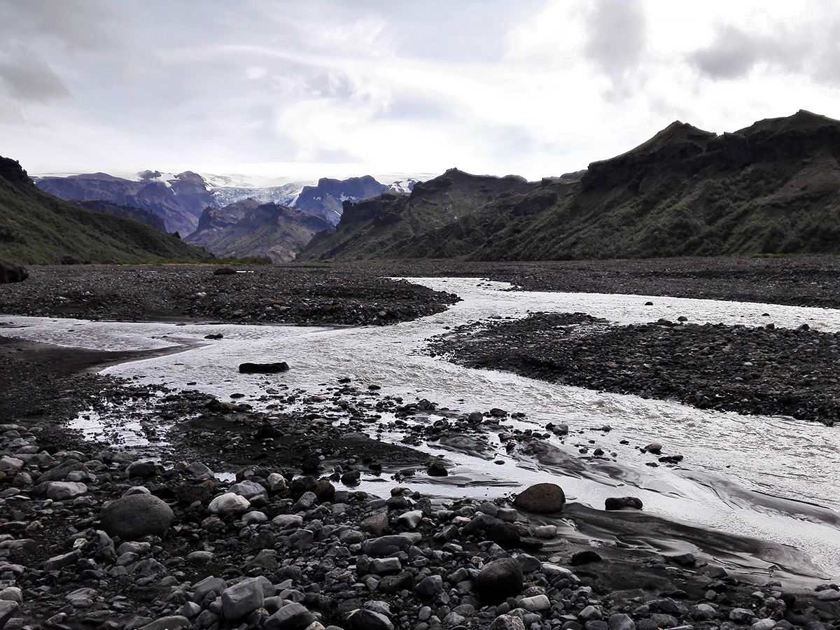
So the next day we went hiking and decided to take a long hiking trail marked on our map that lead into a canyon with a glacier tongue in it. Unfortunately the trail we picked wasn't a very frequently traveled one so...it didn't...really...exist. It was supposed to go somewhere on the lower parts of the mountainside, but we never found it so we decided to take the "easy" was and just walk along the riverbed instead of scaling the mountainside blind. According to the map we might not even have to cross a river on our way there.
Yeah right. Of course the rivers change a lot and fast and the map really just served the purpose of saying "thee are rivers here somewhere", we had to cross five of them just to get out of the riverbed. Probably took about 3-4 hours to get across them all.
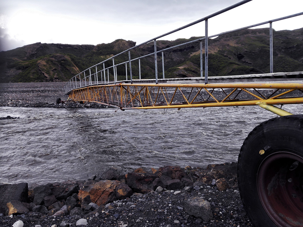

The "main" trail that goes straight across Þórsmörk had portable bridges set up over the large rapids (in the picture above, we checked those out another day), but the direction we were going wasn't anywhere near the main path so there was no choice but to get right into the frigid glacial rivers if we wanted to progress.
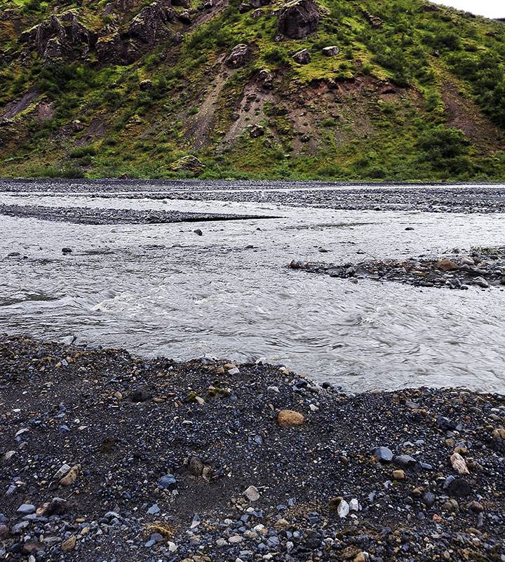
Thankfully we had prepared ourselves for possible river crossings so we had packed lightweight shoes (pictured above) to put on while in the water as to not cut our feet on potential sharp rocks, and still keep our hiking boots dry. Of course we also had walking sticks with us which we used to make sure we weren't about to step into a stealthy deep spot (the water was completely opaque with silt since it was flowing so fast) and to help keep our balance between steps. You really do not want to lose your balance and be swept away by the ice cold stream!
By the way, for those who don't know: when crossing a river like that you always look for the place where it's widest, not narrowest, even though the wide parts can look really scary when you can't see the bottom and the narrow parts look like you could just walze across in a few steps. But it might make the difference between having water up to your knees vs. suddenly having water up to your neck.
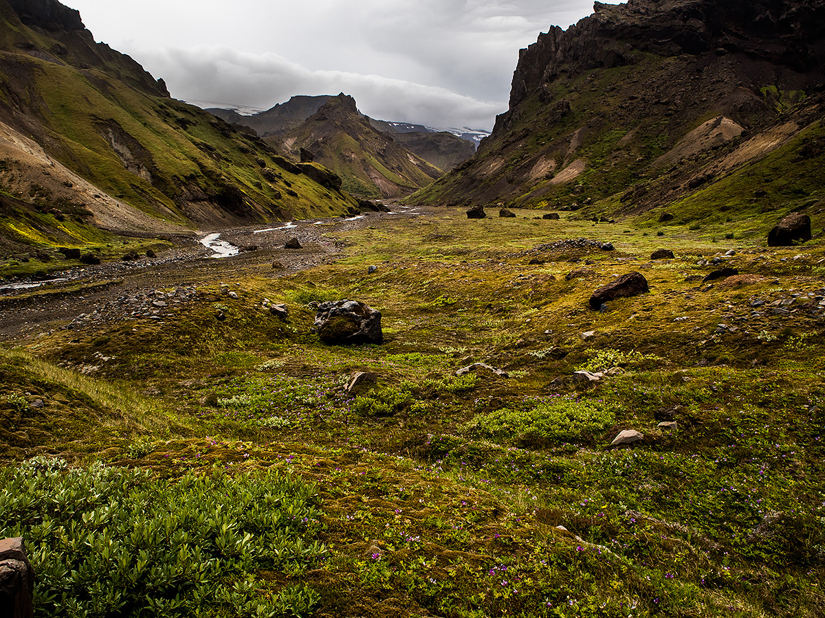
As we finally got out of the riverbed and into the smaller canyon we got to walk on wonderful, soft mossy ground instead of the eternal volcanic sand and boulders, and there was only one small river left that we were able to cross just by jumping from rock to rock when we had to. It was lovely! And warm. But a strong wind was starting to blow from within the canyon as the afternoon progressed and we got closer, and a whole lot of sand started getting in our eyes. At some point me and my mother had to put on sunglasses just to shield our regular glasses from getting scratched up by the sands.
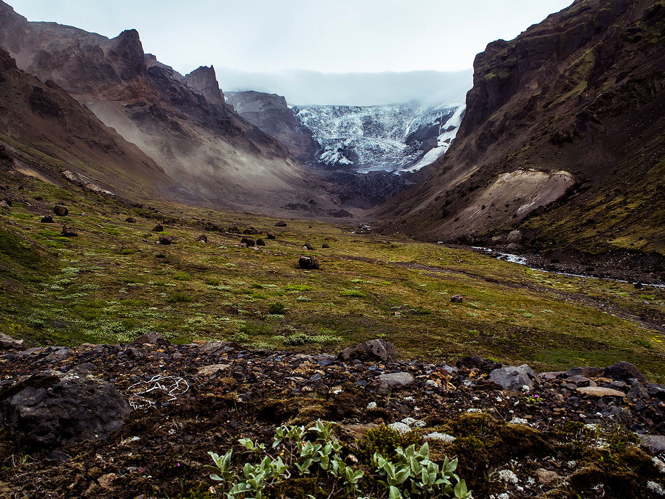
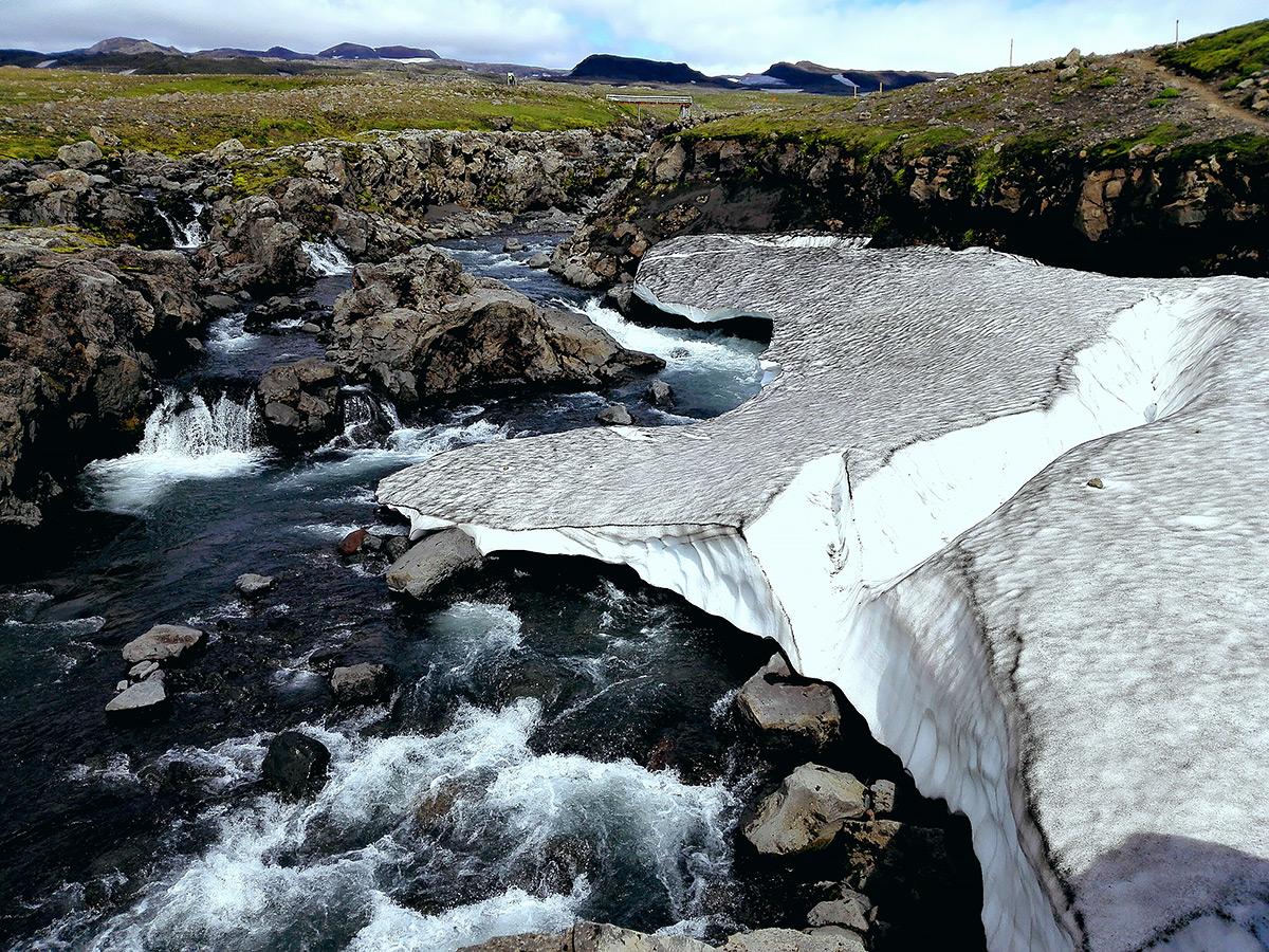
Reaching the valley with a view of the glacier was amazing. The wind was now so strong that I almost fell over a few times and it was really hard to take a photo, and we could see a sandstorm raging by the barren edge of the glacier. We were all alone in the valley and hadn't met another person the whole day, only human marks we had seen were one set of footsteps and one track left by a mountain bike in a couple of sandy ditches, otherwise the place seemed completely untouched by humans.
We decided to turn back now. It was still quite a few kilometers left down into the valley, and we knew we needed our remaining strength on our way back to cross all those rivers again. On top of the raging sandy wind (the light stuff on the lefthand side of the picture is all massive streams of sand being whipped up) there was also some interesting weather starting to flow down from on top of the glacier that we weren't too keen on getting caught in. We had seen the cool view we came for and were happy.
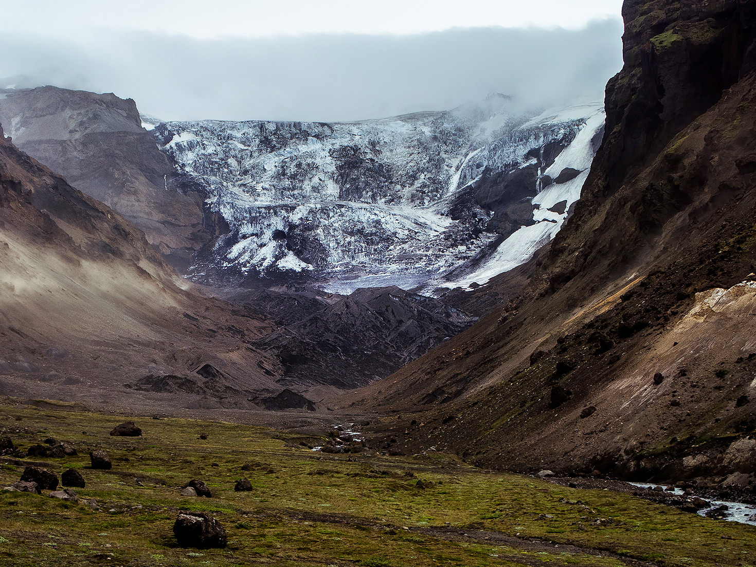
A picture from our way back. The lovely canyon we were in (the one on the left) was filling up with mist by now. This was the first day of our trip that actually had a bunch of rain in the end and we had to whip out our rain jackets at this point.
So, an interesting thing that happened on our way back was that the last river we had to cross had completely changed its course. It was bizarre. By now we had figured out that the rivers move a lot in Þórsmörk, but we had no idea it could happen so suddenly, within one day. We had tried really hard to backtrack correctly so that we'd find the same safe spots that we had crossed on our way in, and so that we wouldn't get lost in this maze of boulders, sand and rapids. Of course our first thought was that we had managed to get lots again. My mother was completely certain that we had crossed some river at the wrong point and had ended up somewhere where we should not be at all and we'd have to backtrack a ton.
It was a bit distressing, honestly. We thought we were lost, couldn't find a place that looked safe to cross, the weather was turning bad and we were still far away from other people. In the end we concluded that it had to be the same river, and that we had no choice but to get across, even though it didn't look as easy this time. And it wasn't. My aunt is the strongest of us three so she always crossed first to check the path, and for the first time she had some real trouble getting to the other side and had to advice me and my mother to look for another spot. It was too dangerous for us, my frame is way too small to withstand the power of deep rapids and my mother has a balance impairment. So we walked upstream until we found a slightly wider spot and this time I had to cross first, with my very terrified mother following a few meters behind constantly pleading for me to not fall into the water. Geeze mom, I wasn't planning to! x3
Well, we made it across at last, eventually walked through the now mostly dried up path where the river had previously flowed, and continued our long walk back to camp in the rain. It was an interesting and exiting day.
We spent another day just leisurely wandering around the main paths of Þórsmörk and not getting ourselves into any more situations, saw an arctic fox (apparently named Kári) chasing birds through the camping grounds, and just looked at stuff. The day after that we took the bus to Skógar near the coast and hike a tiny bit over there too.
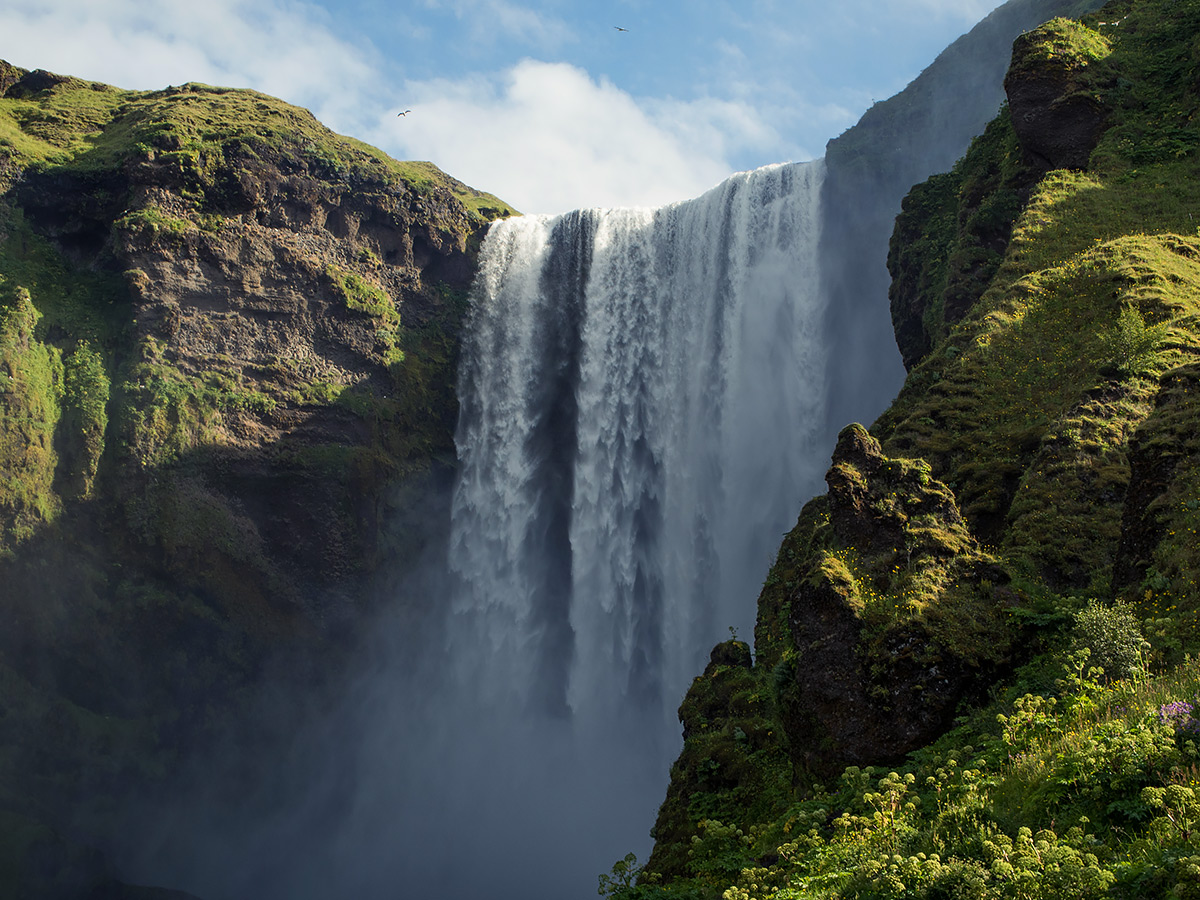
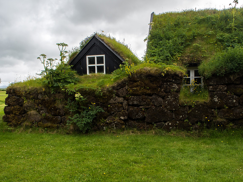
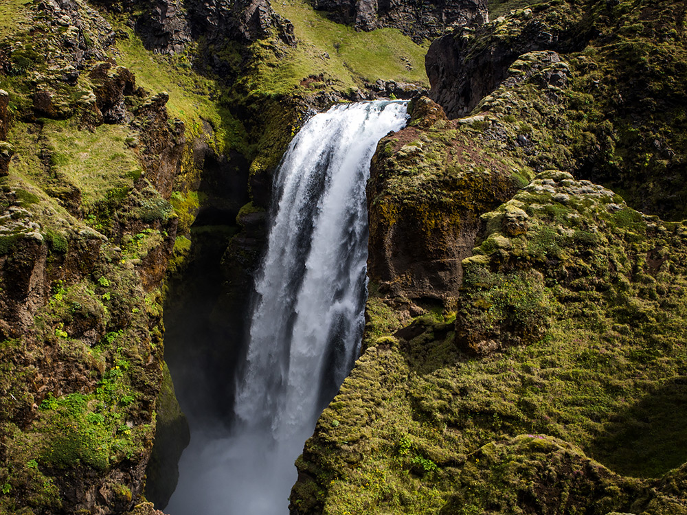
Skógar has one of Iceland's most famous waterfalls, Skógafoss, which is packed with a ton of tourists on buses during the afternoon. We stayed at an absolutely lovely hotel called Hotel Skógar right nearby so we were able to visit the place early in the morning without the crowds, which was neat. There's also a little outdoor museum in Skógar which has old Icelandic buildings on display, and an indoor museum next to it about the history of transportation in Iceland. Really interesting and cool, definitely recommended (I like museums, okay).
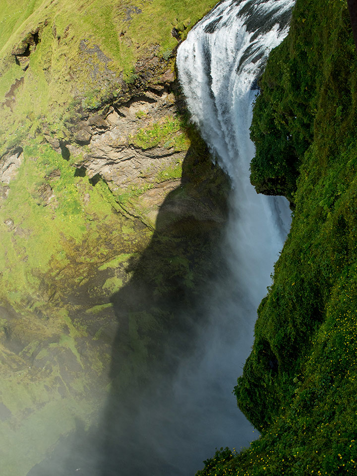
The Skógafoss waterfall has a set of proper stairs leading up to its top for the masses of tourists, after that there's a normal hiking trail for those who want to follow the river up towards the Eyjaflajjajökull and Mýrdalsjökull pass. There was a little fence you have to climb over to reach the hiking trail so that the tourists from buses don't stray onto it and get lost.
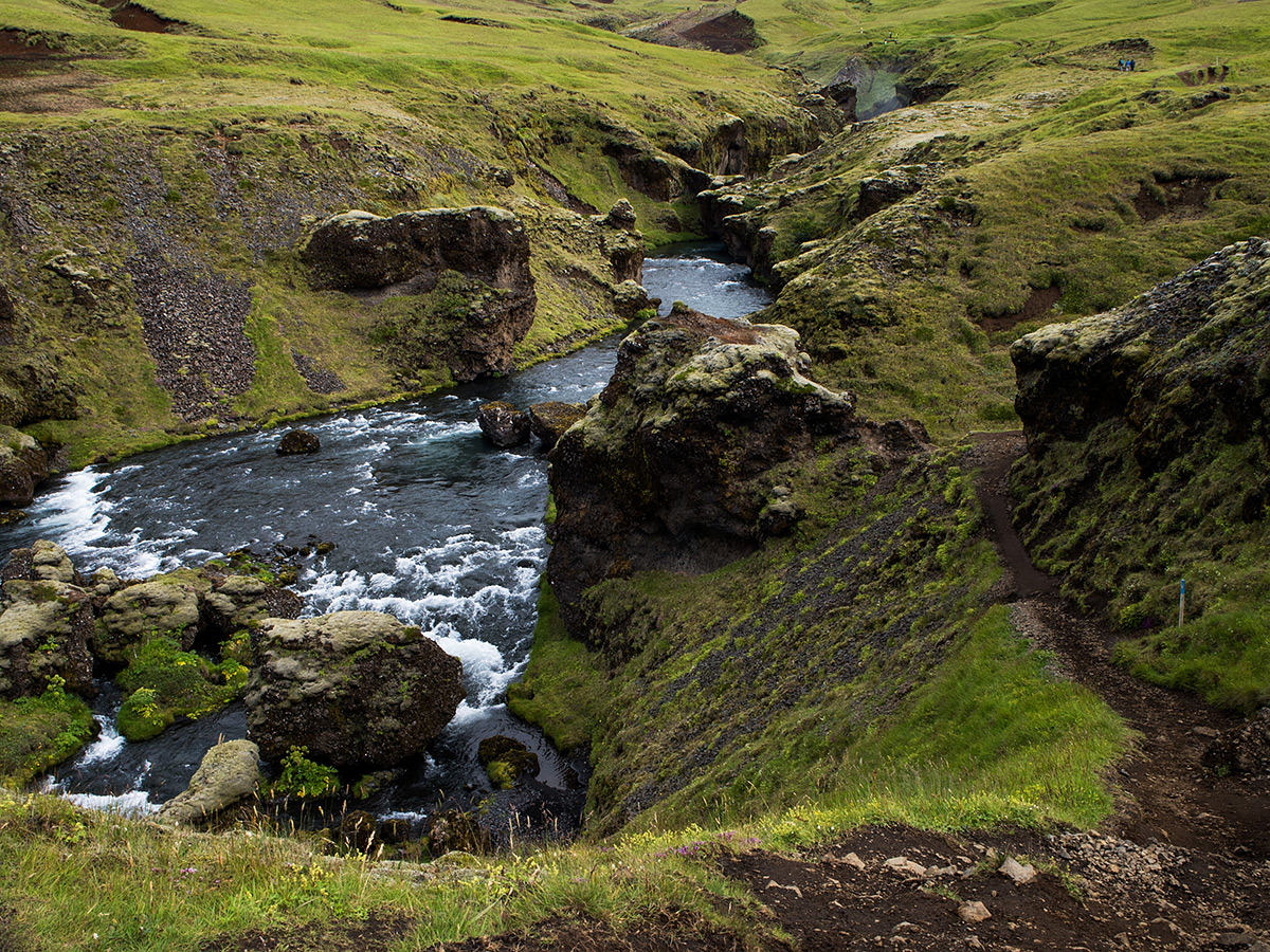
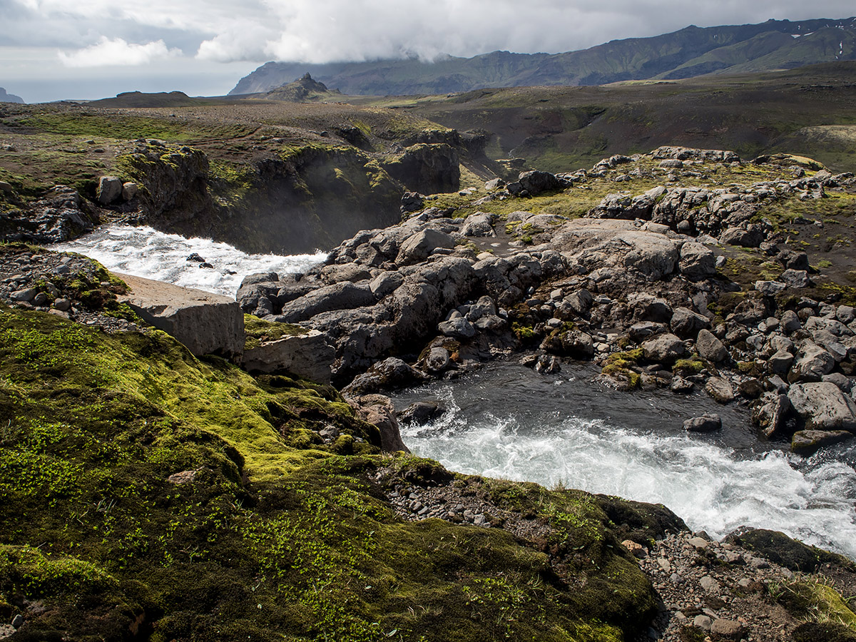
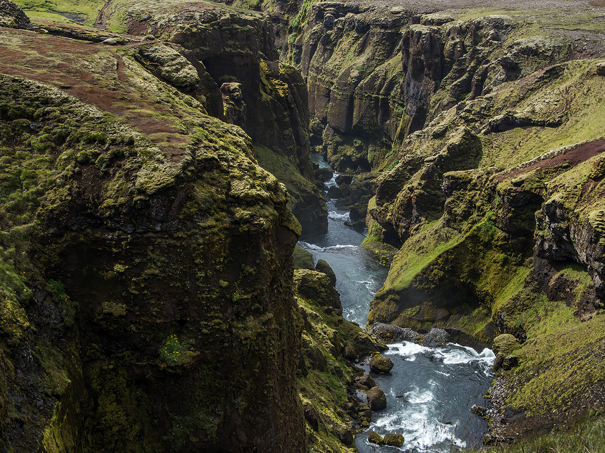
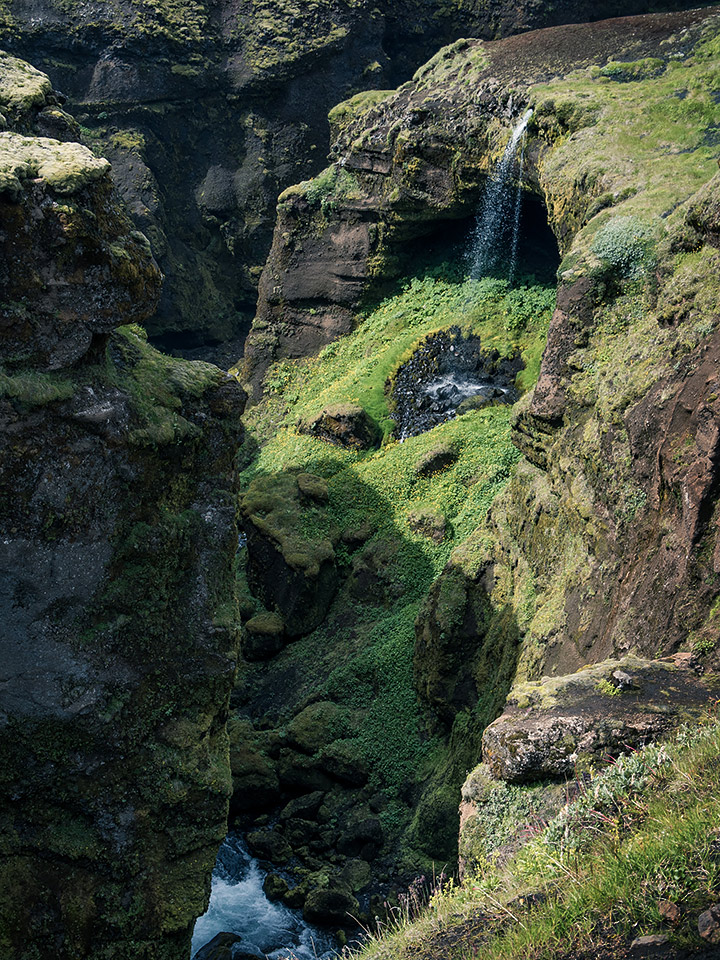
The trail was amazing, full of waterfalls and deep canyons. It's fairly popular so it was properly marked and well travelled (as seen in the left picture above), no getting lost here. There's no safety railings or anything like that, so there were some slightly dangerous parts here and there with wet, muddy, sloping trails by steep canyons and such, but there was always an option to go around the steep paths if you didn't mind not being right next to the view for a moment.
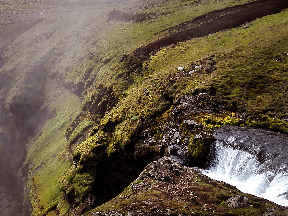
Also, sheep. Those things really manage to get everywhere. When we took breaks we had to be careful not to sit in sheep doo-doo.
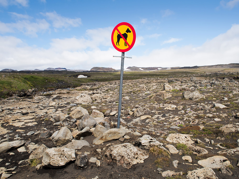
It was about 7-8 km to get this far, high enough for snow and ice. At this point there was a rickety, slightly broken bridge leading across the river (it's visible in the top picture there) and the hiking trail left the vicinity of the river and trailed off across the rocky plains, so it was time to turn back down for us. Btw no dogs allowed anymore, up until this point dogs were allowed in leashes.
That was it for our first week in Iceland. My aunt is a busy professional so her vacation time was over and she had to head back home to Finland the next day, me and my mother steered our way towards Northern Iceland for a second leg of our trip. We were done hiking, it was time to rent a car and do normal touristy stuff.
Getting from Skógar to Akureyri in northern Iceland meant either staying a night in Reykjavik and catch a bus the next day, or trying out the domestic flight system in Iceland. We opted for the latter. The domestic airport is right next to Reykjavik, check in and boarding only took 15 minutes or something, but we spent like 4 hours there because we arrived way early, heh.
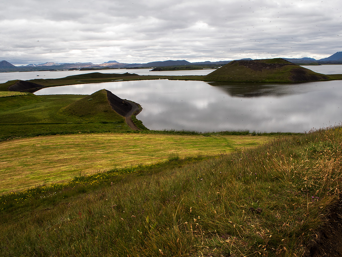
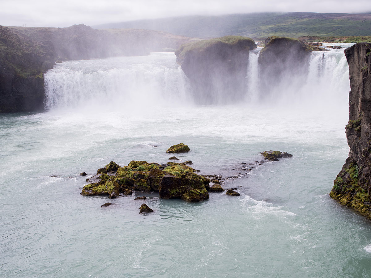
Northern Iceland and the Akureyri area has a lot of awesome stuff to offer. There's bird- and whale watching (none of that for us, sea sickness, ugh), tons of mountains, hiking trails, cool nature phenomena, cute villages. We didn't have any strength for hiking anymore, and it was a bit too cloudy to admire the huge mountains surrounding Akureyri except for a few glimpses now and then, so we drove our rented car to a lake area called Mývatn. It's relatively close by and had many interesting places to see (and so many swarming little bugs on the fields whenever the wind was still for a moment, it's what the lake is named after). On the way there is the gorgeous waterfall Gódafoss.
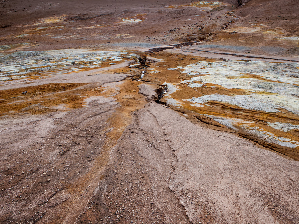
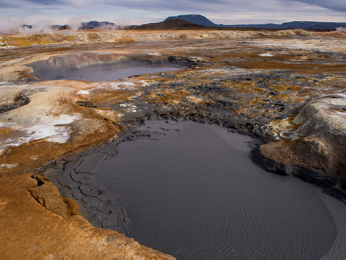
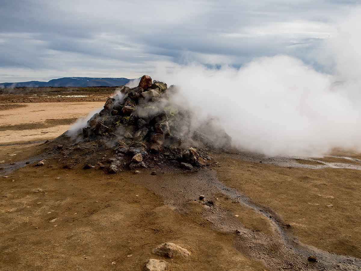
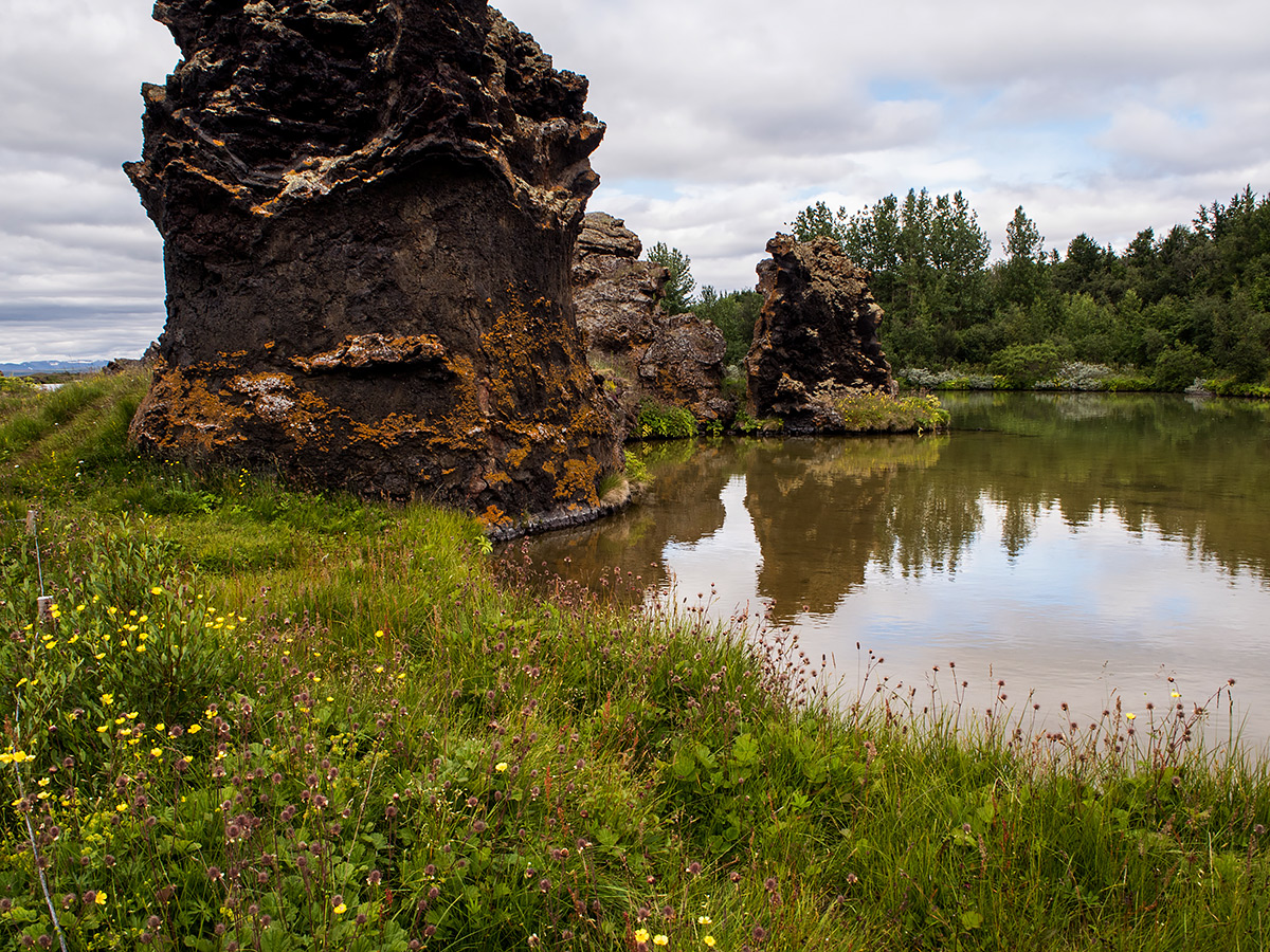
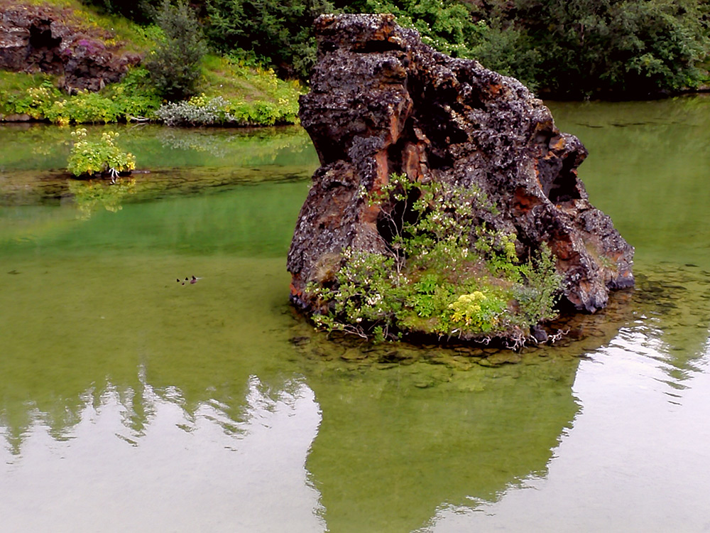
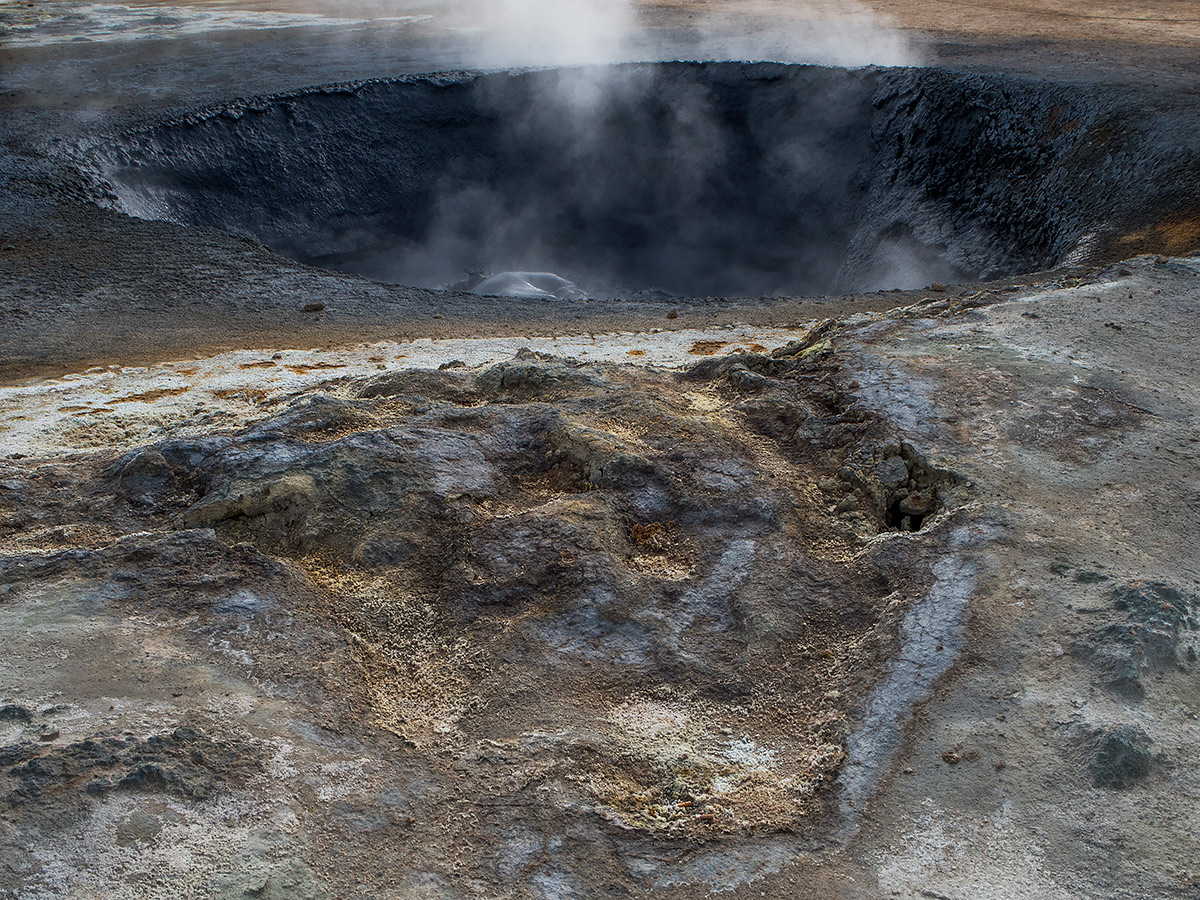
The whole Mývatn area is very volcaninc. There's hot springs (that you're apparently allowed to swim in?), tons of lava caverns and pillars, and smelly geothermal spots. Like this one, near the volcano kalled Krafla, with steam vents and boiling mud pools.
There was also an area called Dimmuborgir, which was basically a massive maze in the lava fileds with different length walking trails through it that was a great place to see. Unfortunately we were there only for about an hour (it was getting late) and the lighting was terribly flat and unforgiving for photography, all the pictures I tried to take ended up like hot garbage and do the place no justice. Google it!
A noteworthy observation was that all the main attractions around Mývatn were really tourist friendly just like the ones near Reykjavik with their boardwalks and clear signage, but had much, much longer walk paths through the terrains and weren't just meant for 10-minute stops for people to take quick photos from buses. There were lots of short and medium walking options to pick from, it was far less crowded (nearly full parking lots everywhere though, it was peak tourist season after all), and there were more families on what seemed like leisurely day trips. Very pleasant and not too hectic.
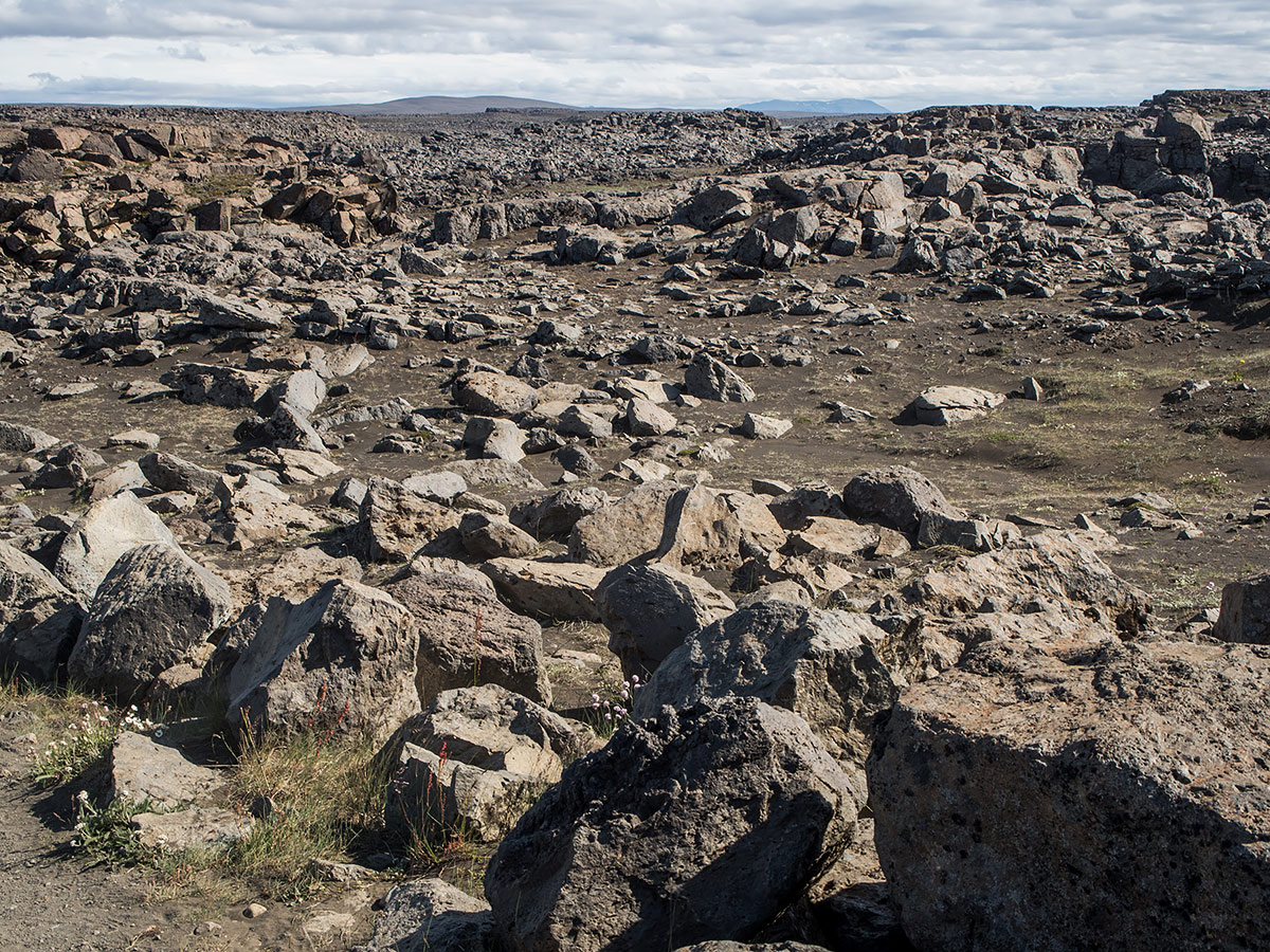
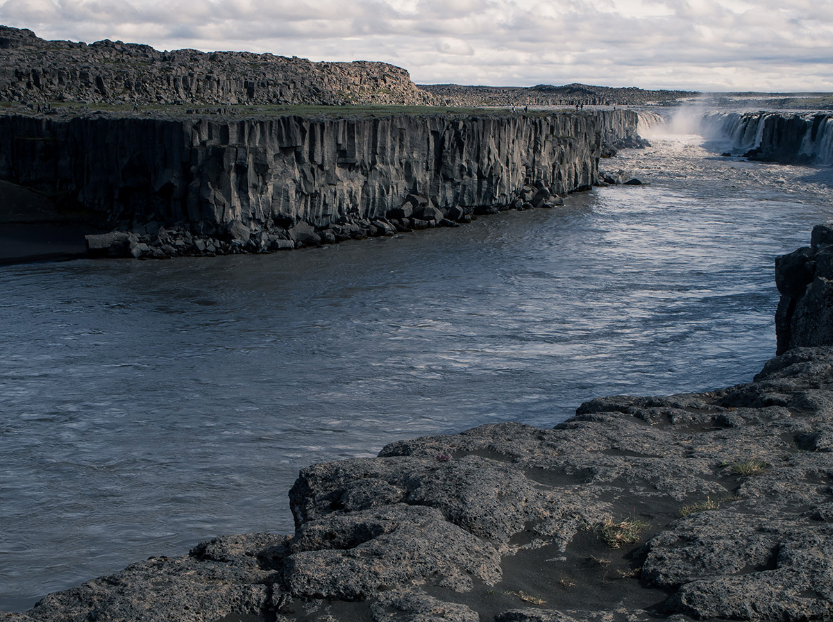
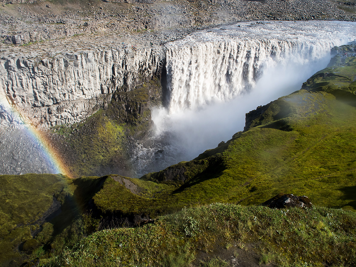
Our final main destination was a little bit of an extra drive away past Mývatn, the Dettifoss waterfall, Iceland's most powerful waterfall, plus its smaller buddy Selfoss. They flow through a depressing, barren landscape of nothing but rocks, stone and rocks. From above the waterfall it's impossible to tell the canyon is even there.
That was pretty much it. We spent our remaining couple of days meandering around Akureyri looking at buildings, visiting parks and just relaxing a bit. It was too misty and rainy to really drive anywhere in between the mountains like we had thought about originally, and we were pretty tired and touristed out at this point anyway We'll probably have to re-visit northern Iceland some other year to properly check out more of it. Our final day was nothing but hours and hours of bus travel to Reykjavík (the bus broke down in the middle of nowhere, heh) and more bus travel to the hotel by the airport in Keflavík, where we slept properly before our plain left. Nice hotel, the airport is super busy in the summer so you have to check your bags hours before the plain leaves, but we could drop off our luggage super early before the massive lines formed and then walk back to the hotel to eat breakfast in peace. Then we flew back home, the end! It was a wonderful trip all around.
~
That was all for this travel journal, hope you enjoyed it. Today's comic page will be up in a about an hour so see you soon. :3